Vista Travel • practical USA travel

Travel the USA with context.

You do not need to book a tour to benefit from our experience. We collect practical information that is genuinely useful on a first — or tenth — trip across the United States.

Find an answer

Where do you want to start?

Choose a topic. Each link jumps directly to the relevant part of the guide.

Travel portal + small-group trips

Knowledge is part of Vista Travel.

We organise only a few small-group trips each year, but this site is meant to help a much wider community of travellers. We want to explain not only what to see, but how parks actually work, where trails begin and what to watch for.

See an example: Zion Shuttle
National parksTransportation, parking, shuttles and seasonal restrictions.
TrailsDistance, difficulty, elevation gain and trailhead.
Weather + elevationCurrent conditions, yearly climate and location elevation in ft / m.
First-hand experienceOur own photos, driven routes and practical notes.
Important from 2026

National park fees for non-US residents.

Beginning January 1, 2026, non-US residents age 16 and older visiting 11 of the most-visited national parks pay the standard entrance fee plus an additional $100 per person, unless they are covered by an eligible annual pass.

Independent travel

Standard entrance + $100

The additional nonresident fee applies at Acadia, Bryce Canyon, Everglades, Glacier, Grand Canyon, Grand Teton, Rocky Mountain, Sequoia & Kings Canyon, Yellowstone, Yosemite and Zion.

Non-Resident Annual Pass

$250 / 12 months

For a private vehicle, the pass covers the vehicle entrance and applicable nonresident fees for the people traveling in that vehicle. Where fees are charged per person, it covers the passholder plus up to three additional adults.

US citizens and residents

Annual Pass: $80

The America the Beautiful Resident Annual Pass costs $80. Single-visit standard entrance fees vary by park and by the way you enter.

Travel with Vista Travel

Park admission is included

Guests on our tour do not pay park entrance fees separately at the gate. Required park admission charges for parks in the itinerary are included in the trip price and handled by the organizer.

On our main route, the additional $100 nonresident rule applies to: Sequoia & Kings Canyon, Yosemite, Grand Canyon, Bryce Canyon and Zion. Death Valley is not one of the 11 parks charging the additional nonresident fee.
Before departure & on the road

The practical side of travelling in the USA.

Open a topic for a concise answer without bureaucratic language. Information checked August 2026. For entry and legal topics we always link to the source so you can verify the latest requirements before travelling.

01ESTA or visa?Entry to the U.S. for Polish passport holders

For an ordinary tourist trip, ESTA is usually enough for a Polish citizen.

Poland participates in the Visa Waiver Program. A traveller with a Polish e-passport may visit for tourism or business for up to 90 days without a visa, but must obtain approved ESTA authorization before travel.

$40.27current ESTA feeup to 90 daysmaximum VWP staygenerally 2 yearsor until passport expiryup to 72 hfor a decision

Important: an approved ESTA authorizes travel to a U.S. port of entry; it does not guarantee admission. CBP makes the final decision. A visa is required for stays over 90 days and in other cases where VWP eligibility does not apply.

Travel to Cuba on or after January 12, 2021, or to North Korea, Iran, Iraq, Libya, Somalia, Sudan, Syria or Yemen on or after March 1, 2011, can — with limited exceptions — make a VWP traveller ineligible for ESTA and require a visa.

Best rule: apply only through the official U.S. government ESTA website. Third-party sites may add large service fees.

02Travel insuranceA poor place to save money before a U.S. trip

Treat strong medical travel insurance as an essential part of the budget.

There is no single federal travel-insurance policy required of every tourist at entry, but medical treatment, hospital care and medical transport in the U.S. can be extremely expensive. Poland's foreign ministry travel information for the U.S. strongly stresses adequate insurance.

Check medical limits, emergency and hospital care, medical transport/evacuation, repatriation, personal liability and the treatment of pre-existing conditions. If you plan to hike, confirm that ordinary outdoor activities and the trails you intend to use are covered.

Do not compare policies by price alone.Limits, exclusions and whether the insurer can organize care and settle directly with a provider matter more.
03Rental carCard holds, protection, fuel and tolls

Compare the final price, not only the advertised daily rate.

Taxes, airport surcharges, additional drivers, one-way drop fees, toll programs and optional extras can change the total substantially. Rental companies commonly place a hold on your card for more than the agreed rental cost, so leave enough available credit.

CDW / LDWAddresses damage to the rental vehicle subject to the contract. It is not the same as medical, personal-property or third-party liability cover.
LiabilityCheck third-party liability separately. Requirements and coverage can depend on the state and rental agreement.
TollsRental-company toll programs are convenient but may add service fees per day, rental or toll event. Read the terms before pickup.
FuelFull-to-full is often the simplest arrangement: collect the car full and return it full. Rental-company refuelling can be more expensive.

Small but useful: delete your phone from the infotainment system before returning the car. The system may retain contacts, call history and navigation destinations.

04Foreign licence & IDPThere is no single rule for all 50 states

Carry your national licence and check whether an IDP is also required.

USA.gov notes that International Driving Permit requirements vary by state. A rental company may also require an IDP under its own policy even where state law is less restrictive.

An IDP does not replace your national driving licence. If required, carry both. A foreign visitor must obtain an IDP before arriving in the United States.

For a multi-state road trip:getting an IDP before departure and checking your specific rental company's policy is the safest practical approach.
05SIM / eSIM & internetEasy in cities, unreliable in remote park country

eSIM is often the easiest option — provided your phone is unlocked.

Check eSIM support, network compatibility and carrier lock status before buying a plan. You can install an eSIM before departure and activate the data plan after arrival. Keeping your home SIM active for SMS and two-factor codes can be useful, while data roaming on that line should be disabled.

Cell service can be weak or absent in national parks and across remote desert roads. Download offline maps, hotel addresses, tickets/reservations and key phone numbers in advance.

The FCC recommends checking device/network compatibility before travel and asking your carrier to unlock the phone when needed.

06TippingWhat is customary and what is merely a screen prompt

Simple rule: full service usually means a tip; counter/self-service is usually optional.

Sit-down restaurant15–20%; 18–20% is an easy default for good serviceTaxi / rideshare15–20%Bar$1–2 per drink or roughly 15–20%Hotel housekeepingabout $2–5 per night

Before adding a tip, check the bill: a gratuity / service charge may already be included, especially for larger groups. A tablet suggesting 20%, 25% or 30% at a counter does not automatically make a tip mandatory.

Traditional etiquette allows the tip to be calculated on the pre-tax subtotal. A tip is a custom, not a sales tax or universal statutory charge.

07Payments, sales tax & cardsWhy checkout may cost more than the shelf price

Cards are the main tool, but carry a backup card and some cash.

U.S. sales tax is imposed at state and local level. Rates vary by state, city and type of purchase, so posted shelf/menu prices often are not the final amount you pay at checkout.

Pay in USDIf a terminal or ATM offers conversion to your home currency, review the exchange rate and markup. Dynamic Currency Conversion may add extra cost.
Check your bankSome cards charge a foreign transaction fee. Review your card terms before departure.
Card holdsHotels and rental-car companies often hold an extra amount for incidentals, so available credit should exceed the booking price.
Plan BA second card from another bank plus a small cash reserve helps if a card is blocked, a terminal fails or cash is required.

Visa explains that DCC is an optional conversion by the merchant or ATM into the cardholder's home currency; in the United States the local transaction currency is USD.

This is a practical travel guide, not legal or insurance advice.Rules can differ by state, and ESTA, airline, rental-company and insurance terms can change. Check the requirements that apply to your own trip before departure.
Zion National Park

Shuttle stops, trails, distance and time.

A practical stop-by-stop guide: choose a shuttle stop, open a trail, and immediately see distance, time, difficulty and elevation gain. Trail data is based on National Park Service information; always check current conditions and closures before hiking.

How to use itDuring shuttle season, Zion Canyon Scenic Drive is closed to private vehicles. The park shuttle is free and does not require a reservation. Visitor Center → Temple of Sinawava takes about 45 minutes. Click a trail below a stop to open the details.
2026 fees: this is one of the 11 parks charging an additional $100 fee for each non-US resident age 16+, unless that visitor is covered by an eligible Annual Pass. Vista Travel guests have required park admission fees included in the trip price.

Zion Canyon Visitor Center

Start of the park shuttle line and a useful trailhead before heading deeper into the canyon.

Pa'rus Trail3.5 mi / 5.6 km · ~2 h · easy
Distance3.5 mi / 5.6 km round tripTimeabout 2 hrDifficultyeasyGainabout 50 ft / 15 m

A paved route along the Virgin River toward Canyon Junction. A great relaxed walk, especially around sunset.

Watchman Trail3.3 mi / 5.3 km · ~2 h · moderate
Distance3.3 mi / 5.3 km round tripTimeabout 2 hrDifficultymoderateGain368 ft / 112 m

A compact but scenic hike ending with views of the Towers of the Virgin, lower Zion Canyon and Springdale.

Zion Human History Museum

Museum, park history and broad views of the Towers of the Virgin. This is mainly an educational and scenic stop.

Trails: no major trailhead starts directly here. Note: you cannot board a shuttle going up-canyon from this stop.

Canyon Junction

Junction of Zion Canyon Scenic Drive and Zion–Mt. Carmel Highway, with access to Pa'rus Trail.

Pa'rus Trail → Visitor Centerup to 3.5 mi / 5.6 km RT · ~2 h · easy
Full route3.5 mi / 5.6 km round tripTimeabout 2 hrDifficultyeasyGainabout 50 ft / 15 m

Walk down-canyon to the Visitor Center and combine the shuttle ride with an easy riverside hike.

You cannot board an up-canyon shuttle from Canyon Junction.

Court of the Patriarchs

Short scenic stop for Abraham, Isaac and Jacob Peaks and The Sentinel.

Court of the Patriarchs Viewpointvery short · ~10–15 min · steep
Distanceabout 150 ft / 46 m one wayTimeabout 10–15 min*Difficultyshort but steepGoalviewpoint

A short paved climb to the classic Court of the Patriarchs viewpoint.

*Vista Travel estimate; NPS gives the trail length but not an average hiking time.

Zion Lodge

Food, restrooms, water and an important trail hub.

Lower Emerald Pool1.2 mi / 1.9 km · ~1 h · easy
Distance1.2 mi / 1.9 km RTTimeabout 1 hrDifficultyeasyGain69 ft / 21 m

Popular walk to the lower pool and small waterfall. Individual segments can close after rockfall or maintenance.

Upper Emerald Pool~3 mi / 4.8 km · ~2.5 h · moderate
Distanceabout 3 mi / 4.8 km RTTimeabout 2.5 hrDifficultymoderateGainabout 360 ft / 110 m

A longer, rougher route climbing to Upper Emerald Pool.

The Grotto Trail1.0 mi / 1.6 km · ~30 min · easy
Distance1.0 mi / 1.6 km RTTimeabout 30 minDifficultyeasyGain35 ft / 11 m

A short connector between Zion Lodge and The Grotto.

Sand Bench Trail7.6 mi / 12.2 km · ~4 h · moderate
Distance7.6 mi / 12.2 km RTTimeabout 4 hrDifficultymoderateGain466 ft / 142 m

A longer sandy hike below The Sentinel for hikers looking for more mileage.

The Grotto

The key stop for West Rim Trail, Scout Lookout and Angels Landing.

Kayenta Trail2.0 mi / 3.2 km · ~1.5 h · moderate
Distance2.0 mi / 3.2 km RTTimeabout 1.5 hrDifficultymoderateGain150 ft / 46 m

Connects The Grotto with the Emerald Pools trail system.

Scout Lookout via West Rim Trail4.2 mi / 6.2 km · ~3 h · strenuous
Distance4.2 mi / 6.2 km RTTimeabout 3 hrDifficultystrenuousGain1,000 ft / 305 m

A strong alternative for hikers who want the big views without continuing onto the Angels Landing chains. No permit is required to Scout Lookout.

Angels Landing5.4 mi / 8.7 km · ~4 h · very strenuous
Distance5.4 mi / 8.7 km RTTimeabout 4 hrDifficultyvery strenuous / exposedGain1,488 ft / 454 m

The final half mile beyond Scout Lookout follows the famous chains along an exposed ridge.

Permit required beyond Scout Lookout to Angels Landing.

The Grotto Trail → Zion Lodge0.5 mi / 0.8 km one way · ~15 min
Distance0.5 mi / 0.8 km one wayTimeabout 15 minDifficultyeasyGoalZion Lodge

A short connector to Zion Lodge. Round trip is about 1 mi / 1.6 km.

Weeping Rock

The stop and short Weeping Rock Trail are open again. Former routes to Hidden Canyon and Observation Point from the canyon remain closed.

Weeping Rock Trail0.4 mi / 0.6 km · ~30 min · short, steep
Distance0.4 mi / 0.6 km RTTimeabout 30 min*Difficultyshort but steepGain98 ft / 30 m

A short climb to the dripping alcove and hanging garden.

Hidden Canyon and the East Rim route to Observation Point from this side remain on long-term closure.

*Vista Travel estimate.

Big Bend

A scenic stop below Angels Landing and the Great White Throne.

Trails: no major signed trailhead starts directly here. This is mainly a viewpoint and photography stop.

Temple of Sinawava

End of the shuttle line and gateway to Riverside Walk and The Narrows.

Riverside Walk2.2 mi / 3.5 km · ~1.5 h · easy
Distance2.2 mi / 3.5 km RTTimeabout 1.5 hrDifficultyeasyGain57 ft / 17 m

A paved walk along the Virgin River to the point where The Narrows begins.

The Narrows — bottom-upup to 9.4 mi / 15.1 km · 1–8 h · strenuous
Distanceup to 9.4 mi / 15.1 km RTTime1–8 hr depending on turnaroundDifficultystrenuous / river hikingGain334 ft / 102 m

The bottom-up hike can be shortened at any point. Much of the route is directly in the Virgin River.

No permit is required for bottom-up hiking, but access depends on river flow, weather and flash-flood risk. Check current NPS conditions first.

Outside the Zion Canyon Shuttle route

Canyon Overlook Trail

This trail does not start at any of the nine shuttle stops. The trailhead is near the east side of the Zion–Mt. Carmel Tunnel and is reached by park road.

Canyon Overlook Trail1.0 mi / 1.6 km RT · ~1 h · moderate
Distance1.0 mi / 1.6 km RTTimeabout 1 hrDifficultymoderateAccessZion–Mt. Carmel Highway

A compact hike to one of Zion’s best viewpoints; parking near the trailhead is limited.

Park by park

Drive, shuttle, hike — what is actually worth doing.

Zion is the first detailed example, but the same idea now extends across the route. Where private cars are allowed, we show a sensible sequence of overlooks and optional hikes. Where shuttle rules apply, we flag them clearly.
Death Valley National Park
private car • scenic drive • desert
How to visit: a car is essential here. Distances are large, cell coverage is limited, and even a short walk can be dangerous around midday in summer.
Areaabout 3.4 million acres / 13,800 km²Badwater Basin−282 ft / −86 mTemperature record134°F / 56.7°C at Furnace CreekHistoryborax + the famous 20-Mule Teams
Death Valley in our photos
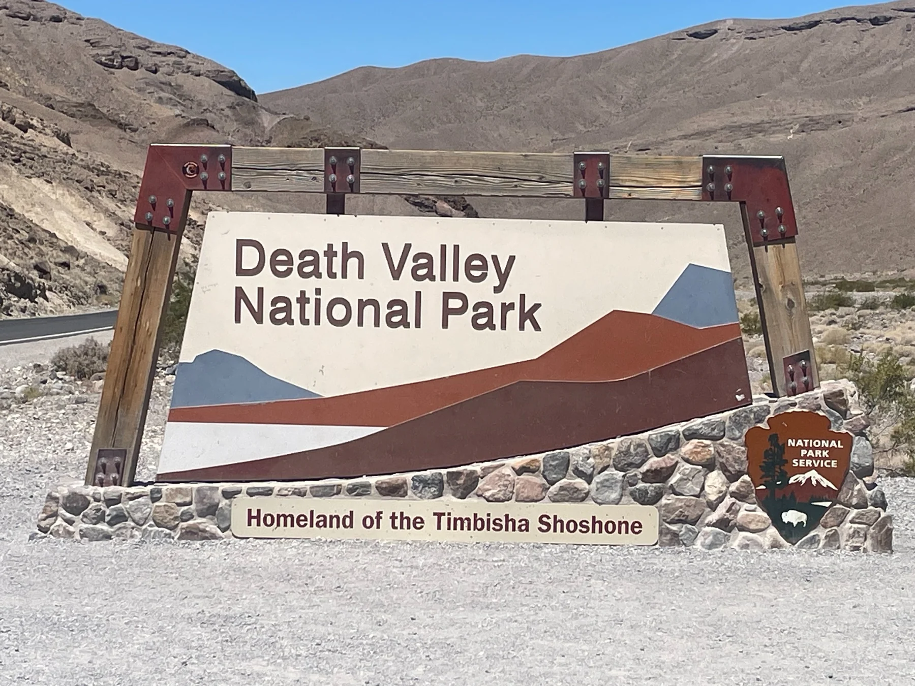
Entrance sign at Death Valley National Park
Death Valley entrance
Badlands in Death Valley
Colorful badlands
Death Valley panorama
Desert panorama
Wide view across Death Valley
A sense of scale
Death Valley
Desert landscape
Colorful hills in Death Valley
Colorful hills
overlook

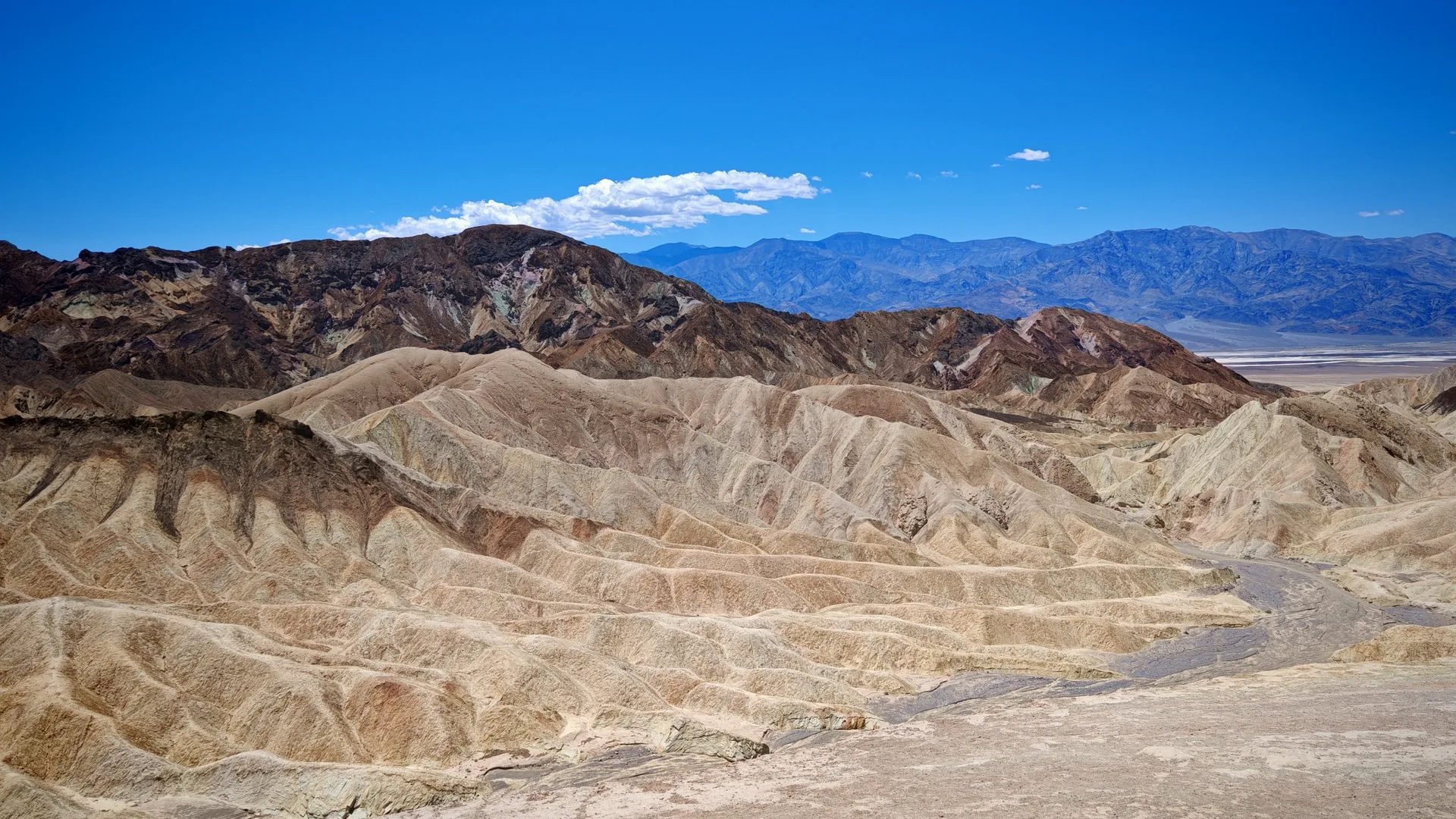
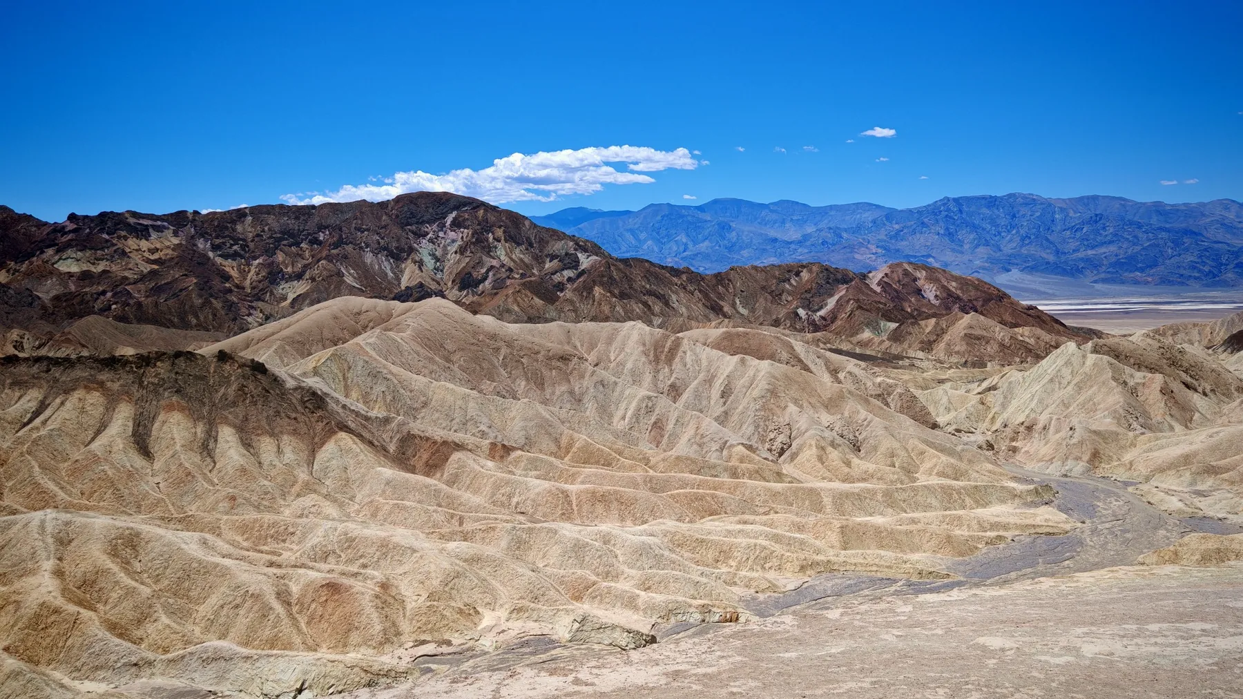
Zabriskie Point

Classic view over golden badlands, especially strong at sunrise or late afternoon.

history

Harmony Borax Works

The perfect place to explain why borax mattered and how it was hauled across the desert.

lowest point

Badwater Basin

Salt flats 282 ft / 86 m below sea level; walking distance should be adjusted to temperature.

9 mi / 14.5 km one-way

Artist’s Drive / Artist’s Palette

A one-way paved scenic road through multicolored hills.

trailhead

Golden Canyon

A proper canyon hike when temperatures are suitable.

dunes

Mesquite Flat Sand Dunes

No fixed trail is required — turn around whenever heat, time or energy says so.

high panorama

Dante’s View

A high overlook that makes the scale of Death Valley immediately understandable.

Optional hikes
Harmony Borax Works Loop0.4 mi / 0.6 km · 30 min · easy
Distance0.4 mi / 0.6 kmTime30 minDifficultyeasyGain50 ft / 15 m
Golden Canyon — Gower Gulch Loop4.3 mi / 6.9 km · 2.5 h · moderate
Distance4.3 mi / 6.9 kmTime2.5 hrDifficultymoderateGain850 ft / 259 m
Mesquite Flat Sand Dunes2.0 mi / 3.2 km · 1.5 h · easy–moderate
Distance2 mi / 3.2 km RTTime1.5 hrDifficultyeasy–moderateGain185 ft / 65 m
Summer: plan longer walks very early. Death Valley is not one viewpoint — it is an enormous road-trip park.
Sequoia National Park — Giant Forest
private car + seasonal shuttle
How to visit: Generals Highway is a driving route, while free shuttles serve Giant Forest in summer. Moro Rock / Crescent Meadow Road closes to private cars on summer weekends and holidays.
2026 fees: this is one of the 11 parks charging an additional $100 fee for each non-US resident age 16+, unless that visitor is covered by an eligible Annual Pass. Vista Travel guests have required park admission fees included in the trip price.
main attraction

General Sherman Tree

From the main parking area the trail descends about 0.5 mi / 0.8 km one way.

easy walk

Giant Forest Museum / Round Meadow

Good base for Big Trees Trail and the shuttle toward Moro Rock.

panorama

Moro Rock

Granite dome with more than 350 steps and broad Sierra views.

drive-through tree

Tunnel Log

A classic road-trip stop on the Moro Rock / Crescent Meadow road.

meadow + sequoias

Crescent Meadow

Quieter Giant Forest scenery and a useful trail hub.

Optional hikes
Big Trees Trail0.75 mi / 1.2 km · ~1 h · easy
Distance0.75 mi / ~1.2 kmTimeabout 1 hrDifficultyeasyStartGiant Forest Museum
Moro Rock0.5 mi / 0.8 km RT · 350+ steps
Distanceabout 0.5 mi / 0.8 km RTTime45–60 min*Difficultyshort, steepSteps350+

*Vista Travel estimate.

Congress Trailabout 2 mi / 3.2 km · 1–1.5 h* · easy–moderate
Distanceabout 2 mi / 3.2 kmTime1–1.5 hr*Difficultyeasy–moderateStartGeneral Sherman

*Vista Travel estimate.

Yosemite National Park
private car + Valley Shuttle • Glacier Point
How to visit: drive into the park, but in Yosemite Valley it is usually smarter to park once and use the free shuttle. Keep the car for Tunnel View, Bridalveil Fall and — when the road is open — Glacier Point.
2026 fees: this is one of the 11 parks charging an additional $100 fee for each non-US resident age 16+, unless that visitor is covered by an eligible Annual Pass. Vista Travel guests have required park admission fees included in the trip price.
iconic view

Tunnel View

El Capitan, Bridalveil Fall and Half Dome in one frame.

short walk

Bridalveil Fall

A roadside parking area and short path to the base of the waterfall.

valley core

Cook’s Meadow / Yosemite Falls

Easy to combine several short walks with the Valley Shuttle.

high viewpoint

Glacier Point

About 30 mi / 48 km and roughly one hour from Yosemite Valley when Glacier Point Road is open.

Glacier Point Road

Sentinel Dome / Taft Point

Two compact hikes from the same road corridor.

Optional hikes
Bridalveil Fall Trail0.5 mi / 0.8 km · 20 min · easy
Distance0.5 mi / 0.8 km RTTime20 minDifficultyeasyGain80 ft / 24 m
Lower Yosemite Fall1 mi / 1.6 km · 30 min · easy
Distance1 mi / 1.6 kmTime30 minDifficultyeasyGain50 ft / 15 m
Sentinel Dome1.8 mi / 3.0 km RT · ~1–1.5 h* · moderate
Distance1.8 mi / 3 km RTTime1–1.5 hr*DifficultymoderateStartGlacier Point Road

*Vista Travel estimate.

Taft Point2.4 mi / 3.9 km RT · ~1.5–2 h* · moderate
Distance2.4 mi / 3.9 km RTTime1.5–2 hr*DifficultymoderateStartGlacier Point Road

*Vista Travel estimate.

Four Mile Trail — downhill only: Glacier Point → Valley4.8 mi / 7.7 km · 3–4 h · strenuous
Distance4.8 mi / 7.7 km one wayTime3–4 hrDirectiondownhill onlyVerticalabout 3,200 ft / 975 m

For Vista Travel this is presented only as a descent from Glacier Point to Yosemite Valley.

There is no regular free shuttle between Yosemite Valley and Glacier Point; trailhead logistics must be planned in advance.

Bryce Canyon National Park
private car + seasonal shuttle
How to visit: the shuttle is useful around the busy amphitheater, but private cars are allowed. The Southern Scenic Drive has no park shuttle, so you drive your own vehicle to its viewpoints.
2026 fees: this is one of the 11 parks charging an additional $100 fee for each non-US resident age 16+, unless that visitor is covered by an eligible Annual Pass. Vista Travel guests have required park admission fees included in the trip price.
amphitheater

Sunrise Point

Viewpoint and one end of the Queen’s Garden / Navajo combination.

amphitheater

Sunset Point

The other key trailhead for Navajo Loop.

panorama

Inspiration Point

Layered views of the Bryce Amphitheater without a long hike.

panorama

Bryce Point

A broad amphitheater perspective and trail hub.

Southern Scenic Drive

Natural Bridge

Easy roadside viewpoint on the high plateau.

9,115 ft / 2,778 m

Rainbow & Yovimpa Points

The park’s highest viewpoints at the end of the scenic drive.

Signature optional hike
Queen’s Garden + Navajo Loop2.9 mi / 4.6 km · 2–3 h · moderate
Distance2.9 mi / 4.6 kmTime2–3 hrDifficultymoderateGain625 ft / 191 m
Grand Canyon — South Rim
car on Desert View Drive + shuttles elsewhere
How to visit: the South Rim has different access zones. Desert View Drive is open to private vehicles, while Hermit Road is shuttle-only from March through November. There is no public parking at the South Kaibab Trailhead.
2026 fees: this is one of the 11 parks charging an additional $100 fee for each non-US resident age 16+, unless that visitor is covered by an eligible Annual Pass. Vista Travel guests have required park admission fees included in the trip price.
Visitor Center

Mather Point

Easy first canyon view and a good start for a short Rim Trail walk.

geology

Yavapai Point

Panorama plus Yavapai Geology Museum.

Village

Bright Angel Trailhead

The most famous corridor trailhead; remember that every downhill step must be climbed back.

23 mi / 37 km scenic road

Desert View Drive

Drive east along the rim and stop at a series of overlooks.

end of scenic road

Desert View Watchtower

Distinctive architecture and strong Colorado River views.

Short canyon hikes
South Kaibab → Ooh Aah Point1.8 mi / 2.9 km RT · ~1.5–2 h* · steep return
Distance1.8 mi / 2.9 km RTTime1.5–2 hr*WaternoneAccessshuttle

*Estimate; NPS advises allowing roughly twice as long to climb out as to descend.

South Kaibab → Cedar Ridge3.0 mi / 4.8 km RT · 2–4 h* · harder
Distance3.0 mi / 4.8 km RTTime2–4 hr*WaternoneRestroomCedar Ridge

NPS identifies Cedar Ridge as a good turnaround for many first-time day hikers.

Heat: inner-canyon conditions can be dramatically hotter than the rim; ambitious descents do not belong in the middle of a hot day.
Monument Valley Navajo Tribal Park
17-mile dirt loop • Navajo Nation
How to visit: the famous 17-mile Valley Drive is unpaved, rough and sandy. Navajo Parks recommends a capable vehicle; an SUV or truck is preferred. Motorcycles and RVs are prohibited on the loop.
Visitor Center

The Mittens & Merrick Butte

The classic panorama is visible before you even enter the valley loop.

scenic drive

17-Mile Valley Drive

Allow extra time for rough terrain, sand and photo stops.

guided access

Guide-only areas

Some formations and side areas are accessible only with Navajo guides.

Hiking
Wildcat Trail1.5 mi per Navajo Parks · time varies
Distance1.5 mi per official pageTimeabout 1–2 hr*Requirementsign in / sign outTerraindesert

*Vista Travel estimate; the official page lists the distance but no average hiking time.

Valley of Fire State Park
private car • roadside sights • seasonal trail closures
How to visit: combine scenic driving with short walks. Many trails close annually from May 15 through September 30 because of extreme heat.
petroglyphs

Atlatl Rock

A quick stop for ancient rock art and cultural context.

rock formations

Arch Rock / Beehives

Easy photography stops near the main road.

White Domes Road

Fire Canyon / Silica Dome Overlook

Colorful landscape and a Star Trek: Generations filming location.

east side

Elephant Rock

Take the very short direct path or a longer loop.

Short hikes
Mouse’s Tank Trail0.7 mi / 1.1 km · ~30–45 min* · easy
Distance0.7 mi / 1.1 kmTime30–45 min*HighlightpetroglyphsTerrainsand / rock
Fire Wave / Seven Wonders Loop1.8 mi / 2.9 km · ~1.5 h · seasonal closure
Distance1.8 mi / 2.9 kmTimeabout 1.5 hrHighlightcolor + slot canyonClosureMay 15 – Sep 30
Elephant Rock Loop1.2 mi / 1.9 km · ~45–60 min* · easy
Loop1.2 mi / 1.9 kmDirect path0.1 mi / 0.16 kmTime45–60 min*StartEast Entrance
Heat: Nevada State Parks discourages hiking above 85°F / 29°C; several longer trails are seasonally closed.
Growing travel portal

More practical topics.

This section will grow alongside new routes and first-hand travel experience.

Coming soon

Parking and access

Where to leave the car and when park transportation is the better option.

Coming soon

First road trip

Distances, fuel, tolls and the realities of long driving days in the USA.

Coming soon

Desert safety

Water, heat, cell coverage and planning in very hot regions.

Coming soon

Understanding park language

Visitor Center, trailhead, scenic drive, overlook and other useful terms.